एंडीज
Appearance
| एंडीज | |
|---|---|
 अर्जेंटीना आ चिली के बीच में एंडीज के हवाई फोटो | |
| Highest point | |
| परबतचोटी | एकांकागुआ (Las Heras Department, Mendoza, अर्जेंटीना) |
| ऊँचाई | 6,961 मी (22,838 फीट) |
| लोकेशन (भूगोलीय) | 32°S 70°W / 32°S 70°Wनिर्देशांक: 32°S 70°W / 32°S 70°W |
| डाइमेंशन | |
| लंबाई | 7,000 किमी (4,300 मील) |
| चौड़ाई | 500 किमी (310 मील) |
| Naming | |
| मूलभाषा में | Error {{native name}}: an IETF language tag as parameter {{{1}}} is required (help) |
| भूगोल | |
| देस | List
|
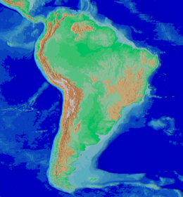
एंडीज दक्खिन अमेरिका में एगो परबत बाटे; ई संसार के सभसे लम्बा परबत हवे। एकरा साथे ई बिस्व के दुसरा सभसे ऊँच परबत श्रेणी भी बा, हिमालय के बाद। एंडीज के सभसे ऊँच चोटी एकांकागुआ अर्जेंटीना में बाटे।
संदर्भ
[संपादन करीं]| ई दक्खिन अमेरिका के अस्थान या भूगोल से संबंधित लेख एगो आधार बाटे। जानकारी जोड़ के एकरा के बढ़ावे में विकिपीडिया के मदद करीं। |

