
चित्र:Nepal location map.svg

Size of this PNG preview of this SVG file: 800 × 476 पिक्सेल. अउरी रिजोल्यूशन: 320 × 190 पिक्सेल | 640 × 381 पिक्सेल | 1,024 × 609 पिक्सेल | 1,280 × 762 पिक्सेल | 2,560 × 1,523 पिक्सेल | 1,200 × 714 पिक्सेल.
ओरिजनल फाइल (एसवीजी फाइल, नॉमिनली 1,200 x 714 पिक्सल, फाइल के आकार: 296 KB)
सारांश
| बिबरण |
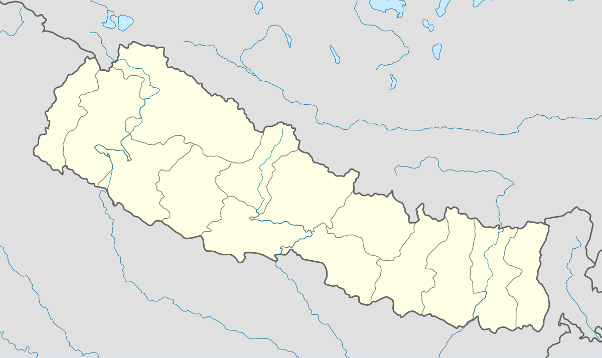
English: Location map of Nepal including the 14 administrative zones (outdated since 2015).
Equirectangular projection. Strechted by 113.0%. Geographic limits of the map: * N: 31.0° N * S: 26.0° N * W: 79.5° E * E: 89.0° EMade with Natural Earth. Free vector and raster map data @ naturalearthdata.com. |
| तारीख | |
| स्रोत | आपन रचना |
| लेखक | Uwe Dedering |
| Other versions |
|


लाइसेंसिंग
I, the copyright holder of this work, hereby publish it under the following licenses:
ई फाइल Creative Commons Attribution-Share Alike 3.0 Unported लाइसेंस की तहत लाइसेंसी बा।
- आप फ्री बानी:
- साझा करे खातिर – रचना के नकल करे, बाँटे आ दुसरी जगह भेजे खातिर
- रीमिक्स करे खातिर – काम के अपनी हिसाब से बनावे खातिर
- नीचे दिहल कारणन की तहत:
- एट्रीब्यूशन – लाइसेंस के कड़ी दे के उचित श्रेय (क्रेडिट) दिहल जरूरी बा आ अगर कौनों बदलाव कइल गइल बा तब ओहू के बतावल जाए के चाहीं। आप ई काम कौनों उचित तरीका से क सकत बानी, बाकी ई न झलके के चाहीं की जेकरा लगे लाइसेंस बा ऊ राउर चाहे राउर काम के समर्थन करत बाटे या सही बतावत बा।
- शेयर अलाइक (share alike) – अगर आप एह सामग्री के आधार बना के कुछ रिमिक्स करत बानी, रूप बदलाव करत बानी, चाहे कुछ जोड़ के सामग्री के बढ़ावत बानी, आपके आपन योगदान ठीक एही या कंपेटिबल लाइसेंस जइसन कि ओरिजनल बाटे, के तहत होखे के चाहीं।

|
जीएनयू फ्री डाकुमेंटेशन लाइसेंस, वर्जन 1.2 या फिर कौनो भी बाद के प्रकाशित फ्री साफ्टवेयर फाउंडेशन लाइसेंस के शर्त के तहत, एह डाकुमेंट के नकल करे, बितरण करे आ/भा बदलाव करे के परमीशन दिहल गइल बा; एह में इनवैरिएंट खंड सभ नइखे शामिल, मुखपृष्ट के पाठ नइखे शामिल, आ बैक-कभर के पाठ नइखे शामिल। लाइसेंस के एगो प्रति जीएनयू फ्री डाकुमेंटेशन लाइसेंस नाँव के खंड में दिहल गइल बा। |
रउआँ अपनी जरूरत के लाइसेंस बीछ सकत बानीं।
फाइल के इतिहास
ओ समय ई फाइल कइसन लउके ई देखे खातिर कौनों तारीख/समय पर क्लिक करीं।
| तारीख/समय | चिप्पी रूप | डाइमेंशन | प्रयोगकर्ता | टिप्पणी | |
|---|---|---|---|---|---|
| वर्तमान | 17:46, 18 फरवरी 2010 | | 1,200 × 714 (296 KB) | Uwe Dedering | no disputed countries |
| 13:05, 18 फरवरी 2010 |  | 1,200 × 714 (297 KB) | Uwe Dedering | {{Information |Description={{en|1=Location map of Nepal. Equirectangular projection. Strechted by 113.0%. Geographic limits of the map: * N: 31.0° N * S: 26.0° N * W: 79.5° E * E: 89.0° E Made with Natural Earth. Free vector and raster map data |
फाइल के उपयोग
कौनों पन्ना नइखे जवन ए फाइल के इस्तेमाल करत होखे।
बैस्विक फाइल उपयोग
नीचे दिहल अउरी विकिसभ पर एह फाइल के इस्तेमाल हो रहल बा:
- ar.wikipedia.org पर इस्तेमाल
- arz.wikipedia.org पर इस्तेमाल
- ast.wikipedia.org पर इस्तेमाल
- Everest
- Himalaya
- Makalu
- Kala Patthar
- Ama Dablam
- Cho Oyu
- Gokyo
- Namche Bazaar
- Nuptse
- Glaciar de Khumbu
- Lukla
- Katmandú
- Módulu:Mapa de llocalización/datos/Nepal
- Lhotse
- Dhaulagiri
- Manaslu
- Annapurna
- Módulu:Mapa de llocalización/datos/Nepal/usu
- Aeropuertu Tenzing-Hillary
- Aeropuertu de Bajhang
- Aeropuertu de baxura
- Aeropuertu de Bhadrapur
- Aeropuertu de Bharatpur
- Aeropuertu de Bhojpur
- Aeropuertu de Biratnagar
- azb.wikipedia.org पर इस्तेमाल
- ba.wikipedia.org पर इस्तेमाल
- be-tarask.wikipedia.org पर इस्तेमाल
- bn.wikipedia.org पर इस्तेमाल
- bpy.wikipedia.org पर इस्तेमाल
- ceb.wikipedia.org पर इस्तेमाल
- ce.wikipedia.org पर इस्तेमाल
- ckb.wikipedia.org पर इस्तेमाल
- de.wikipedia.org पर इस्तेमाल
- dty.wikipedia.org पर इस्तेमाल
- el.wikipedia.org पर इस्तेमाल
एह फाइल के अउरी बैस्विक इस्तेमाल देखीं