
चित्र:LocationBritishIsles.png
ए से उच्च गुणवत्ता उपलब्ध नइखे।
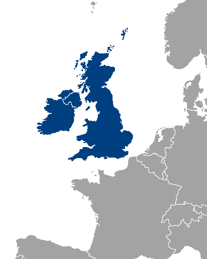
LocationBritishIsles.png (414 × 516 पिक्सेल, फाइल साइज: 9 KB, MIME टाइप: image/png)
Location map of Great Britain and Ireland.
| |
This work has been released into the public domain by its author, Vardion, at the अंगरेजी विकिपीडिया project. This applies worldwide. In case this is not legally possible: |
फाइल के इतिहास
ओ समय ई फाइल कइसन लउके ई देखे खातिर कौनों तारीख/समय पर क्लिक करीं।
| तारीख/समय | चिप्पी रूप | डाइमेंशन | प्रयोगकर्ता | टिप्पणी | |
|---|---|---|---|---|---|
| वर्तमान | 00:46, 14 नवंबर 2013 | | 414 × 516 (9 KB) | Fobos92 | . |
| 09:34, 17 सितंबर 2007 |  | 1,245 × 1,245 (52 KB) | Sony-youth | With the CI highlighted. | |
| 10:43, 1 मई 2007 |  | 1,245 × 1,245 (33 KB) | Tene~commonswiki | Optimised (0) | |
| 02:51, 21 अगस्त 2006 |  | 1,245 × 1,245 (81 KB) | Hoshie | I have added Montenegro and removed Vojvodina, which is a part of Serbia | |
| 13:12, 10 जुलाई 2006 |  | 1,245 × 1,245 (81 KB) | MPF | new hi-res version | |
| 17:19, 11 फरवरी 2005 |  | 250 × 115 (3 KB) | Iota~commonswiki | Location map of Great Britain and Ireland. |
फाइल के उपयोग
फाइल के इस्तेमाल पन्ना करत बा:
बैस्विक फाइल उपयोग
नीचे दिहल अउरी विकिसभ पर एह फाइल के इस्तेमाल हो रहल बा:
- als.wikipedia.org पर इस्तेमाल
- an.wikipedia.org पर इस्तेमाल
- be-tarask.wikipedia.org पर इस्तेमाल
- be.wikipedia.org पर इस्तेमाल
- bs.wikipedia.org पर इस्तेमाल
- ca.wikipedia.org पर इस्तेमाल
- ca.wiktionary.org पर इस्तेमाल
- cy.wikipedia.org पर इस्तेमाल
- da.wikipedia.org पर इस्तेमाल
- de.wikipedia.org पर इस्तेमाल
- el.wikipedia.org पर इस्तेमाल
- en.wikipedia.org पर इस्तेमाल
- Category:British Isles
- User:Yorkshire Phoenix
- User:Owain/Userbox/British Isles
- User:Meshsa
- Talk:Ireland/Archive 5
- User:Matt Lewis/Nationality within the British Isles (including the United Kingdom and Ireland)
- User:Matt Lewis/Nationality labelling guide for the Republic of Ireland and the United Kingdom of Great Britain and Northern Ireland (including England, Scotland, Wales and the British Islands)
- User:D Dinneen/Userboxes
- en.wiktionary.org पर इस्तेमाल
- eo.wikipedia.org पर इस्तेमाल
- es.wikipedia.org पर इस्तेमाल
- eu.wikipedia.org पर इस्तेमाल
- frr.wikipedia.org पर इस्तेमाल
- fy.wikipedia.org पर इस्तेमाल
- gl.wikipedia.org पर इस्तेमाल
- gv.wikipedia.org पर इस्तेमाल
- hr.wikipedia.org पर इस्तेमाल
- hu.wikipedia.org पर इस्तेमाल
- hy.wikipedia.org पर इस्तेमाल
- id.wikipedia.org पर इस्तेमाल
- incubator.wikimedia.org पर इस्तेमाल
- is.wikipedia.org पर इस्तेमाल
- is.wiktionary.org पर इस्तेमाल
- it.wikipedia.org पर इस्तेमाल
- ka.wikipedia.org पर इस्तेमाल
- kk.wikipedia.org पर इस्तेमाल
- ko.wikipedia.org पर इस्तेमाल
- lb.wikipedia.org पर इस्तेमाल
- lt.wikipedia.org पर इस्तेमाल
- ms.wikipedia.org पर इस्तेमाल
- nl.wikipedia.org पर इस्तेमाल
एह फाइल के अउरी बैस्विक इस्तेमाल देखीं