
चित्र:Caldey Island map 1952.jpg
ए नमूना के साइज: 800 × 368 पिक्सेल. अउरी रिजोल्यूशन: 320 × 147 पिक्सेल | 640 × 294 पिक्सेल | 1,024 × 471 पिक्सेल | 1,280 × 589 पिक्सेल | 2,400 × 1,104 पिक्सेल.
ओरिजनल फाइल (2,400 × 1,104 पिक्सेल, फाइल साइज: 172 KB, MIME टाइप: image/jpeg)
This work is an Ordnance Survey map over 50 years old, which is covered by Crown Copyright which in this case expires 50 years after publication. Ordnance Survey does however ask that they be credited and that the date of publication be given.
Any ancillary rights gained through the creation of the electronic version are granted as freely usable under any circumstances.
|
This work created by the United Kingdom Government is in the public domain.
This is because it is one of the following:
HMSO has declared that the expiry of Crown Copyrights applies worldwide (ref: HMSO Email Reply)
|
 |
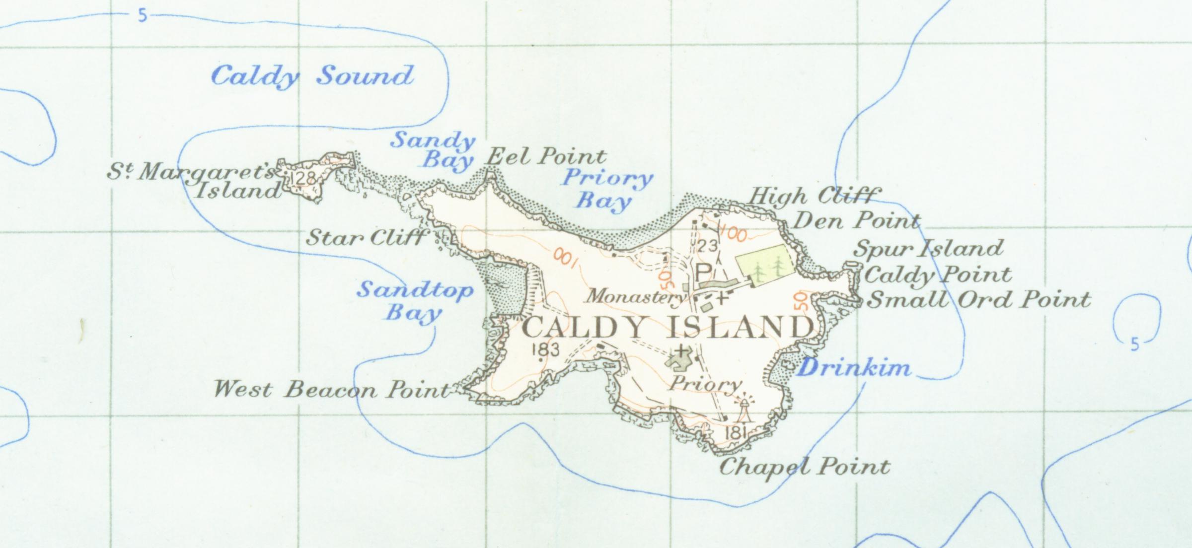
| बिबरण | Map of caldey island from 1952 scale one inch to the mile scanned at 600 DPI |
| तारीख | |
| स्रोत | OS map carmarthen and tenbysheet 152 1952 |
| लेखक | OS |
फाइल के इतिहास
ओ समय ई फाइल कइसन लउके ई देखे खातिर कौनों तारीख/समय पर क्लिक करीं।
| तारीख/समय | चिप्पी रूप | डाइमेंशन | प्रयोगकर्ता | टिप्पणी | |
|---|---|---|---|---|---|
| वर्तमान | 02:19, 24 फरवरी 2007 | | 2,400 × 1,104 (172 KB) | Geni | {{oldOS}} {{Information |Description=Map of caldey island from 1952 scale one inch to the mile scanned at 600 DPI |Source=OS map carmarthen and tenbysheet 152 q952 |Date=1952 |Author=OS |Permission=none needed |other_versions= }} |
फाइल के उपयोग
फाइल के इस्तेमाल पन्ना करत बा:
बैस्विक फाइल उपयोग
नीचे दिहल अउरी विकिसभ पर एह फाइल के इस्तेमाल हो रहल बा:
- ar.wikipedia.org पर इस्तेमाल
- br.wikipedia.org पर इस्तेमाल
- bs.wikipedia.org पर इस्तेमाल
- ca.wikipedia.org पर इस्तेमाल
- cy.wikipedia.org पर इस्तेमाल
- en.wikipedia.org पर इस्तेमाल
- et.wikipedia.org पर इस्तेमाल
- fr.wikipedia.org पर इस्तेमाल
- hu.wikipedia.org पर इस्तेमाल
- it.wikipedia.org पर इस्तेमाल
- kn.wikipedia.org पर इस्तेमाल
- nl.wikipedia.org पर इस्तेमाल
- ru.wikipedia.org पर इस्तेमाल
- te.wikipedia.org पर इस्तेमाल
- www.wikidata.org पर इस्तेमाल